

New IndiGen Blogpost
From archival clues to digital maps
06.05.2025
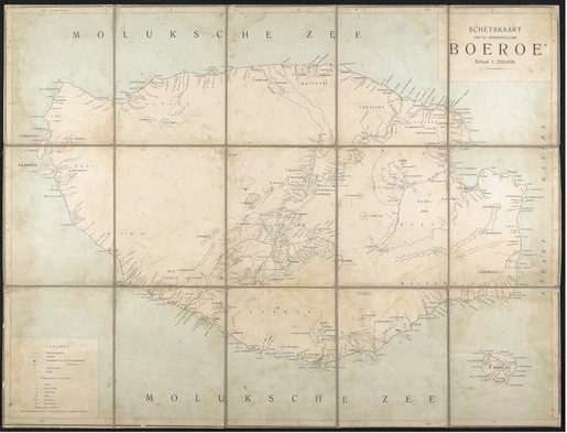
This Dutch map of the island Buru, published by the Topographische Inrichting Batavia in 1910, was used during the expedition, as indicated by hand written remarks. Highlighting the expedition’s contribution to the geographical knowledge of the time, this map proved essential for the reconstruction of their route on Buru. University Archive Munich, Inv. No. NL–75–6.
From archival clues to digital maps: Reflections on reconstructing the route of the II. Freiburg Moluccan Expedition
By Julia Siebert
Over the past few weeks, in my position as a student assistant for the research project Markus Mailopu and the ‘II. Freiburg Moluccan Expedition,' I have been working to reconstruct and reassemble the route of the II. Freiburg Moluccan Expedition. This effort led to a digital exhibition that is now part of the Mailopu Archive.